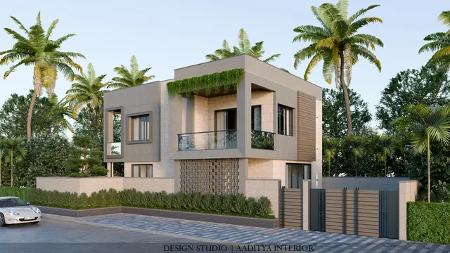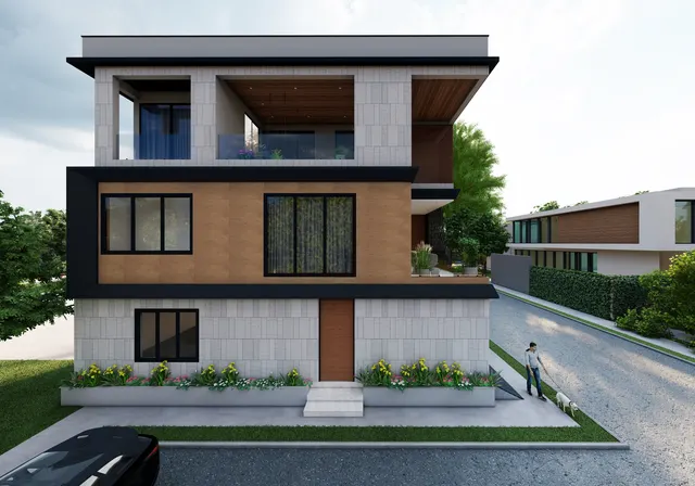



A family buys a 1,500 sq ft plot on a nine-metre society road in Katargam, hires a draughtsman, and receives a tidy four-storey plan. Then the file reaches the Surat Municipal Corporation, and it comes back marked up: that height is not allowed on a road that narrow, the front margin is short of the minimum, and the top floor pushes the total floor area past what the plot is permitted. Months are lost redrawing, and the dream house shrinks by a floor. None of it was bad luck. Every one of those limits was written down, in public, before the plot was even bought — in the GDCR.
GDCR stands for General Development Control Regulations: the part of a city's development plan that controls how a plot may be built on. It decides the permitted use, how much floor area may be built, how tall the building may rise, how far it must stand from each boundary, how much parking it must hold, and how the plan is approved and certified. In Gujarat these rules were unified in 2017 as the Comprehensive General Development Control Regulations — usually written CGDCR 2017 — notified by the state's Urban Development and Urban Housing Department. Before 2017, each city ran its own GDCR; the CGDCR replaced most of them with one common rulebook, applied locally by the municipal corporation or the area development authority.
For most homeowners the GDCR is invisible until it is not. It surfaces when a plan is submitted for approval, when a finished building is inspected for its building-use (BU) permission, when a bank asks for the sanctioned plan before releasing a loan, or when a buyer's advocate checks whether that extra floor was ever legally sanctioned. This article explains, in plain language, the handful of GDCR ideas that decide what and how much a homeowner can build — FSI, margins, height and parking — and the steps from drawing to BU permission. The figures used are indicative, commonly applied Gujarat values (with Surat examples) meant to show the shape of the rules; confirm the exact numbers for any plot with the local authority and a licensed architect.
What the GDCR actually is — and when it stops you
The GDCR is the rulebook that turns a city's broad development plan into site-level limits. It answers four questions for any plot: what may be built there (the zone and permitted use), how much may be built (floor space index), how big the building may be (height, floors and the open margins around it), and what services it must provide (parking, a common plot in larger schemes, fire safety and so on). In Gujarat these answers now come from the Comprehensive General Development Control Regulations 2017, a single state-wide regulation applied by each local body — the Surat Municipal Corporation and SUDA in and around Surat, AUDA in Ahmedabad, VUDA in Vadodara, and the respective corporations and area development authorities elsewhere.
The rules bite at specific moments. A plan drawn outside them is returned at scrutiny and cannot be sanctioned. A building constructed with an unapproved deviation can be refused its BU permission, which in turn blocks the lawful occupancy, the completion certificate, the home loan disbursement and, often, a clean resale. In serious cases the authority can order the illegal portion demolished. An unauthorised extra room or floor is therefore not a quiet private gain; it is a cloud over the title of the whole property. The GDCR consistently rewards the owner who designs within it from the first sketch rather than seeking regularisation afterwards.
One caveat is stated here once and meant throughout the article. The CGDCR has been amended several times since 2017, and some provisions vary by city, zone, scheme and road. Every number below is an indicative, commonly applied value included to help a homeowner understand how the rules are structured — not a substitute for the current official regulation. Before buying, designing or applying, confirm the figures that apply to a specific plot with the local authority (for Surat, the SMC and SUDA Town Development Department) and with a licensed architect or town planner entitled to sign the submission.
The words printed on your sanctioned plan
A sanctioned plan is covered in terms that homeowners nod along to without quite knowing. Six of them do almost all the work, and understanding them makes the rest of this article — and any conversation with an architect — far easier. The table below defines each in plain language, because every later rule is built from these pieces.
| Term | What it means | Why it matters to you |
|---|---|---|
| Plot area | The legal area of the land as per the sanctioned sub-plot / 7-12 and city survey records | Every limit below is calculated from this number, not the area the broker quotes |
| Zone / permitted use | The land-use the plot falls in (residential, commercial, mixed, agricultural, etc.) | Decides whether a home, a shop or both are even allowed there |
| FSI (Floor Space Index) | Total permitted built-up floor area divided by plot area | Sets how much total floor you may build — the single biggest constraint |
| Margin / setback | The open distance you must leave between the building and each plot boundary | Decides the footprint, light, ventilation and fire access |
| Road width | The width of the public road the plot abuts | Drives both the maximum height and the front margin |
| Ground coverage | The share of the plot the building footprint may cover at ground level | Caps how much of the plot the building sits on |
FSI: how much floor area you are allowed to build
Floor Space Index is the heart of the GDCR. It is a simple ratio: the total built-up floor area permitted on a plot, divided by the plot area. An FSI of 1.8 on a 150 square-metre plot permits about 270 square metres of built-up floor area in total — which the owner can arrange as a larger ground floor and a smaller first, or spread evenly over more floors, within the height and margin rules. FSI is why two plots of identical size can legally carry very different houses: the permitted floor area is the same, but the zone, the road and the premiums bought can change the ceiling.
Gujarat's CGDCR works with three FSI numbers, and the difference between them is money. The base FSI is the floor area allowed as of right. The chargeable FSI (often called premium FSI) is extra floor area the owner may buy from the authority by paying a premium — commonly set as a percentage of the official Jantri land rate. The maximum FSI is the ceiling after the chargeable portion is added. For an ordinary residential plot the base is often around 1.8, with chargeable FSI taking the maximum to roughly 2.7; along wider roads and in transit corridors the maximum climbs further. The figures below are indicative bands to show the pattern, not a schedule to design from.
| Residential situation (indicative CGDCR 2017) | Base FSI | Typical maximum FSI with premium | Note |
|---|---|---|---|
| Ordinary residential plot (R1-type) | ≈ 1.8 | ≈ 2.7 | Chargeable FSI bought at a percentage of Jantri rate |
| Plot near a wider arterial road (within a set distance) | ≈ 1.8 | ≈ 3.6 – 4.0 | Higher ceilings along 36 m / 45 m roads and ring roads |
| Special transit / CBD nodes (where notified) | ≈ 1.8 | Higher still | Transit-oriented zones; strict conditions apply |
| Gamtal / certain old-settlement zones | As notified | Often no chargeable FSI | Rules differ markedly; confirm locally |
Two practical points save a great deal of disappointment. First, FSI is measured in built-up area as the GDCR defines it, which is not the carpet area a family lives in and not the super built-up area a builder markets — some elements are counted, some are exempt, and the architect reconciles them. Second, buying the maximum FSI is rarely the same as being able to use it, because the height and margin rules may cap the building long before the FSI is exhausted. On a narrow road, a plot can run out of permitted height while floor area is still available on paper.
Margins and setbacks: the open space the law keeps around the home
A margin, or setback, is the open distance that must be left between the building and a plot boundary. The GDCR fixes a minimum front margin (towards the road), side margins and a rear margin, and the building footprint must sit inside what remains. These margins are not bureaucratic cruelty: they bring light and air to each home, keep buildings far enough apart to slow the spread of fire, leave room for a fire tender to approach, and allow services to be laid and maintained. On a tight urban plot they are the difference between a house that breathes and a dark box.
The front margin is tied mainly to the width of the road the plot faces: a house on a wide road must set back further than one on a lane. The rule is usually written as a stepped table, and the required margin is the larger of this road-based figure and a separate margin derived from the building's height. The bands below are indicative CGDCR 2017 values; a corner plot must meet the front margin on every road it abuts.
| Abutting road width | Indicative front margin | Comment |
|---|---|---|
| Up to 9 m | ≈ 2.5 m | Typical narrow society / internal road |
| Over 9 m to 12 m | ≈ 3.0 m | Common residential colony road |
| Over 12 m to under 18 m | ≈ 3.0 – 4.5 m | Steps up as the road widens |
| 18 m to under 30 m | ≈ 6.0 m | Sector / collector road |
| 30 m to under 45 m | ≈ 7.5 m | Arterial road |
| 45 m and above | ≈ 9.0 m | Major arterial / highway-side |
Side and rear margins for a single-family house depend mainly on plot size (and increase for taller buildings). Very small plots may be allowed to build boundary-to-boundary on the sides; as plots grow, the GDCR asks for a margin on one side, then both, plus a rear margin. The pattern below is indicative for single-family dwellings; apartment buildings follow stricter tables.
| Plot size (single-family dwelling) | Indicative rear margin | Indicative side margin |
|---|---|---|
| Up to about 80 m² | Not required | Nil, or 1 m on one side |
| Over 80 up to 150 m² | Not required | ≈ 1.5 m on one side |
| Over 150 up to 300 m² | ≈ 2.0 m | ≈ 1.5 m on one side |
| Over 300 up to 500 m² | ≈ 3.0 m | ≈ 2.0 m on both sides |
| Over 500 m² | ≈ 3.0 m | ≈ 3.0 m on both sides |
Height and the number of floors
How tall a building may rise is governed mostly by the width of the road it faces, with wider roads permitting greater height — because taller buildings need wider approaches for fire tenders and generate more traffic. Height is measured to the top of the building as the GDCR defines it, and it interacts with the margins: a taller building must usually leave larger marginal distances. For a homeowner the practical takeaway is blunt — the road in front of the plot quietly sets the realistic number of floors long before any architectural ambition does.
| Abutting road width | Indicative maximum height | Rough number of floors* |
|---|---|---|
| Under 9 m | ≈ 10 m (a little more for low-rise homes) | G+2 to G+3 |
| 9 m to 12 m | ≈ 16.5 m | Up to about G+4 |
| 12 m to 18 m | ≈ 30 m | Mid-rise |
| 18 m to 36 m | ≈ 45 m | High-rise (extra conditions) |
| 36 m and above | ≈ 70 m | Tall building (full high-rise code) |
*Floor counts are rough because they depend on floor-to-floor height, stilts, parking levels and whether the building is a home or an apartment block. Tall buildings trigger a separate layer of requirements — fire-fighting systems, lifts, refuge areas, structural scrutiny and so on — that go well beyond what a single house needs. Plots near an airport approach also need height clearance from the Airports Authority of India, which can override the road-based figure entirely.
Parking, ground coverage, common plot and the smaller rules
Beyond FSI, margins and height sit a set of quieter rules that still shape a home. Parking is required in proportion to the built-up area and the use, expressed in car-space equivalents; a home must park its own vehicles on plot rather than on the street, and stilt or basement parking is counted and detailed carefully. Ground coverage caps the share of the plot the building footprint may occupy, keeping part of the land open even where margins alone might allow more. Larger plotting schemes must hand over a common plot — shared open space — and provide internal roads of a minimum width, which is why a bungalow scheme has that central garden.
Several more provisions routinely affect homes: the minimum sizes and ventilation of habitable rooms (which dovetail with the National Building Code), staircase and passage widths, the height and design of the compound wall and gate, rainwater harvesting for plots above a threshold size, and projection rules for balconies, chhajjas and porches over the margin. Mixed-use plots that allow a shop on the ground floor carry their own frontage and parking conditions. None of these is onerous on its own, but together they decide whether a design can actually be sanctioned, so an architect checks them in parallel, not at the end.
From drawing to building-use (BU) permission
The approval journey has a clear shape, even if the counter names change by city. It begins long before design — with confirming the plot's title, zone and road width — and ends only when the finished building earns its building-use permission, the document that makes lawful occupancy, loan disbursement and clean resale possible. The timeline below is the typical route for a home in a Gujarat urban authority; the architect or a liaison consultant drives it, and online submission has shortened several steps.
Two steps deserve emphasis. At scrutiny, the authority may ask for changes and will compute the fees and any chargeable-FSI premium; these are a real line in the budget, not an afterthought. During construction, many authorities require a plinth-level inspection before work rises above the plinth, and the finished building is checked against the sanctioned plan before BU permission is granted. Building exactly to the approved drawings is what makes the final certificate straightforward — and quietly protects the resale value for years.
GDCR mistakes homeowners make
- Buying the plot before checking its zone, permitted use and abutting road width — the three things that cap everything else.
- Assuming the broker's plot area; design to the area in the sanctioned sub-plot and city-survey records instead.
- Confusing FSI built-up area with carpet or super built-up area, then over-estimating how big the house can be.
- Buying maximum FSI without checking whether height and margins will even let you use it on a narrow road.
- Treating margins as negotiable — covering a side margin for one more room is a classic cause of BU refusal.
- Forgetting on-plot parking and the compound-wall and gate rules until the design is frozen.
- Deviating from the sanctioned plan during construction and hoping to regularise later.
- Skipping the licensed architect's sign-off and the plinth-level check to save time, then losing far more at BU stage.
- Ignoring rainwater harvesting, common-plot or fire requirements that apply above certain plot or height thresholds.
- Relying on indicative numbers (including these) instead of confirming the current CGDCR provisions for the exact plot.
Frequently asked questions
What is the difference between GDCR and CGDCR?
GDCR is the general term — General Development Control Regulations. CGDCR 2017 is Gujarat's current, common version: the Comprehensive General Development Control Regulations notified by the state in 2017, which replaced most city-specific GDCRs with one rulebook applied by each local authority. In everyday conversation in Gujarat, when people say "GDCR" they usually mean the CGDCR as amended.
How do I find the FSI and margins for my specific plot?
Start with the plot's zone and abutting road width from the sanctioned layout and the local authority's development plan, then apply the CGDCR tables for that zone. In practice a licensed architect or town planner reads the current regulation against your exact plot and confirms it at the authority's Town Development Department. Treat any online calculator or article (including this one) as indicative only.
Can I build right up to my boundary?
Only where the GDCR allows it — typically on the sides of very small plots. Most plots must leave side and rear margins that grow with plot size and building height, and a front margin set by the road width. Covering a required margin is one of the most common reasons a building is denied its BU permission.
What happens if I build more than the sanctioned plan?
An unapproved deviation can block the building-use permission and therefore lawful occupancy, loan disbursement and clean resale, and in serious cases the authority can order the unauthorised portion removed. Regularisation is not guaranteed and can be costly. Designing within the GDCR from the start is far cheaper than fixing a deviation later.
Does the GDCR replace the National Building Code?
No — they work together. The GDCR controls planning-level matters (use, FSI, margins, height, parking). The National Building Code of India 2016 governs building-level matters such as room sizes and ventilation, fire and life safety, and structural and services design. A sanctioned home has to satisfy both, which is why an architect checks them in parallel.
Sources & standards
- Urban Development and Urban Housing Department, Government of Gujarat — Comprehensive General Development Control Regulations (CGDCR) 2017 and subsequent amendments
- Surat Municipal Corporation / SUDA — Town Development Department, CGDCR provisions and plan-approval procedure (indicative city example)
- AUDA (Ahmedabad) and VUDA (Vadodara) — area development authority GDCR provisions, for comparison
- Bureau of Indian Standards — National Building Code of India 2016 (room sizes, fire and life safety, structural and services requirements that accompany the GDCR)
- Airports Authority of India — height clearance requirements near airport approach zones
- Indicative FSI, margin and height bands here are commonly applied CGDCR 2017 values for understanding only — confirm the current provisions for the exact plot with the local authority and a licensed architect before buying or designing